oa Basrah
Access full text
Chapter
- Authors: Prof. Spiro N. Pollalis and Nader Ardalan
- Source: Gulf Sustainable Urbanism – Past, Volume II , pp 110-173
- Publication Date: December 2018
- DOI: https://doi.org/10.5339/GSU.9789927118968_2

Full text loading...
/deliver/fulltext/9789927118968/9789927118968-ch08.html?itemId=/content/chapter/9789927118968.b_9789927118968-ch08&mimeType=html&fmt=ahah
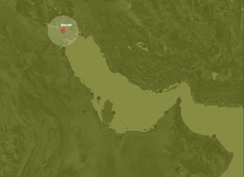
Basrah
Hamad bin Khalifa University Press (HBKU Press) , 110 (2018); https://doi.org/10.5339/GSU.9789927118968_2
/content/chapter/9789927118968.b_9789927118968-ch08
/content/chapter/9789927118968.b_9789927118968-ch08
View:
Figures
Figures
/content/figure/9789927118968.b_9789927118968-ch08.b-9789927118968_008-unfig1
Untitled
9789927118968/b-9789927118968_008-unfig1_thmb.gif
9789927118968/b-9789927118968_008-unfig1.gif
/content/figure/9789927118968.b_9789927118968-ch08.b-9789927118968_008-unfig2
Untitled
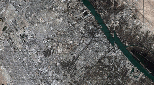
Basrah 2010
-
▸
Area: 181 km2
▸
Population: 3,500,000
▸
Density: 19,337/km2
9789927118968/b-9789927118968_008-unfig2_thmb.gif
9789927118968/b-9789927118968_008-unfig2.gif
Basrah 2010
-
▸
Area: 181 km2
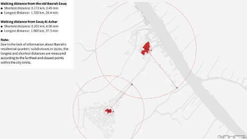
▸
Population: 3,500,000
▸
Density: 19,337/km2
/content/figure/9789927118968.b_9789927118968-ch08.b-9789927118968_008-unfig3
Untitled
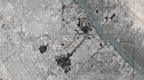
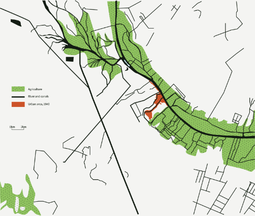
Basrah 1940
-
▸
4.9 km2
▸
Population: 93,000 approx.
▸
Density: 18,976/km2
9789927118968/b-9789927118968_008-unfig3_thmb.gif
9789927118968/b-9789927118968_008-unfig3.gif
Basrah 1940
-
▸
4.9 km2
▸
Population: 93,000 approx.
▸
Density: 18,976/km2
/content/figure/9789927118968.b_9789927118968-ch08.b-9789927118968_008-fig8.1
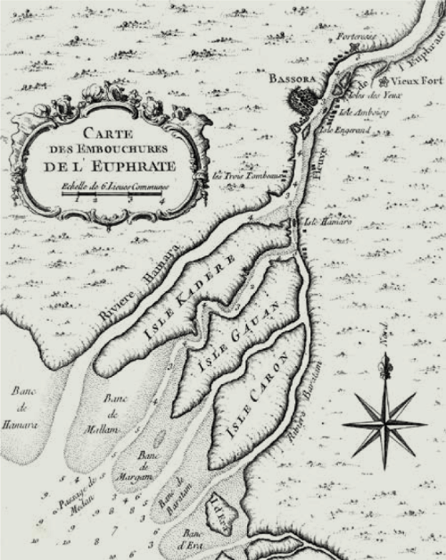
FIGURE 8.1
Basrah, 1764
9789927118968/b-9789927118968_008-fig1_thmb.gif
9789927118968/b-9789927118968_008-fig1.gif
FIGURE 8.1
Basrah, 1764
/content/figure/9789927118968.b_9789927118968-ch08.b-9789927118968_008-fig8.2
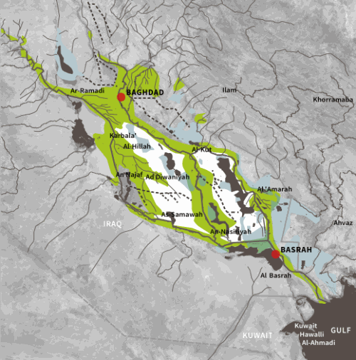
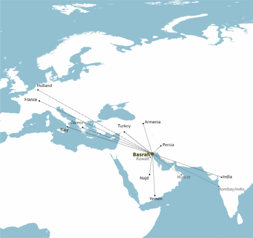
FIGURE 8.2
Regional context of Basrah
9789927118968/b-9789927118968_008-fig2_thmb.gif
9789927118968/b-9789927118968_008-fig2.gif
FIGURE 8.2
Regional context of Basrah
/content/figure/9789927118968.b_9789927118968-ch08.b-9789927118968_008-fig8.3
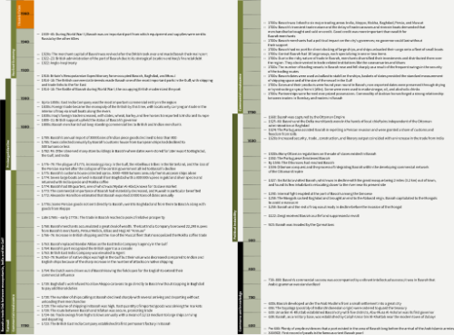
FIGURE 8.3
Economic and political timeline of Basrah
9789927118968/b-9789927118968_008-fig3_thmb.gif
9789927118968/b-9789927118968_008-fig3.gif
FIGURE 8.3
Economic and political timeline of Basrah
/content/figure/9789927118968.b_9789927118968-ch08.b-9789927118968_008-fig8.4
FIGURE 8.4
Temperature and humidity variation
9789927118968/b-9789927118968_008-fig4_thmb.gif
9789927118968/b-9789927118968_008-fig4.gif
FIGURE 8.4
Temperature and humidity variation
/content/figure/9789927118968.b_9789927118968-ch08.b-9789927118968_008-fig8.5
FIGURE 8.5
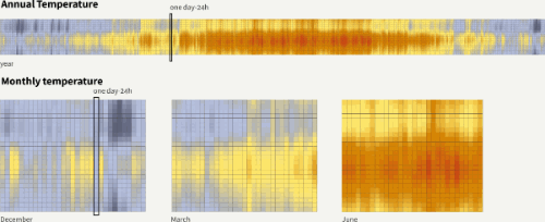
Outdoor dry bulb temperature
Each column represents one day, each cell represents one hour
9789927118968/b-9789927118968_008-fig5_thmb.gif
9789927118968/b-9789927118968_008-fig5.gif
FIGURE 8.5
Outdoor dry bulb temperature
Each column represents one day, each cell represents one hour
/content/figure/9789927118968.b_9789927118968-ch08.b-9789927118968_008-fig8.6
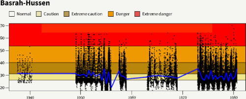
FIGURE 8.6
Annual heat index (°C)
9789927118968/b-9789927118968_008-fig6_thmb.gif
9789927118968/b-9789927118968_008-fig6.gif
FIGURE 8.6
Annual heat index (°C)
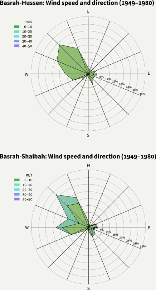
/content/figure/9789927118968.b_9789927118968-ch08.b-9789927118968_008-fig8.7
FIGURE 8.7
Wind variations
9789927118968/b-9789927118968_008-fig7_thmb.gif
9789927118968/b-9789927118968_008-fig7.gif
FIGURE 8.7
Wind variations
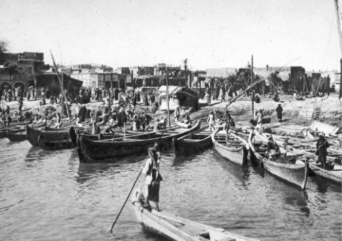
/content/figure/9789927118968.b_9789927118968-ch08.b-9789927118968_008-img8.1
IMAGE 8.1
Ashar Creek, Basrah
9789927118968/b-9789927118968_008-img1_thmb.gif
9789927118968/b-9789927118968_008-img1.gif
IMAGE 8.1
Ashar Creek, Basrah
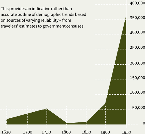
/content/figure/9789927118968.b_9789927118968-ch08.b-9789927118968_008-fig8.8
FIGURE 8.8
Population growth, Basrah, 1620–1950
9789927118968/b-9789927118968_008-fig8_thmb.gif
9789927118968/b-9789927118968_008-fig8.gif
FIGURE 8.8
Population growth, Basrah, 1620–1950
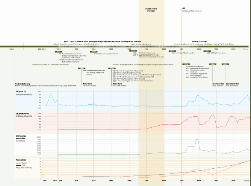
/content/figure/9789927118968.b_9789927118968-ch08.b-9789927118968_008-fig8.9
FIGURE 8.9
Timeline
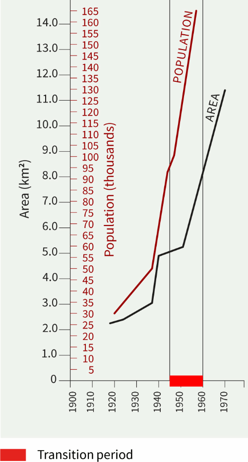
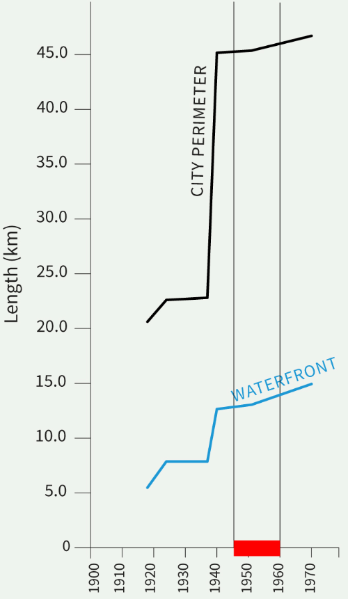
The past-to-present transitional period for Basrah in Iraq is identified from the mid-1940s to the late 1950s, when a series of key events occurred in the city. In 1930, the ownership of Basrah port and custom duties was transferred from Britain to the Iraqi government, coinciding with the first commercial extraction of oil for Iraq. Equally during the 1930s, the first elementary and secondary schools were opened in the city, and the first commercial telephone services were established. In 1938, the Basrah Petroleum Company was founded, and the first Friday mosque was built with funds from oil revenues. The first city expansion plan to densify the area between the historic core and the banks of the Shatt Al-Arab was undertaken in 1940. Major increases in oil extraction and oil revenue per capita, as well as number of people living in the city, were observed in the same decade. It has to be noted, though, that the transitional period from the 1930s to 1940s was primarily socioeconomic; major infrastructure works did not take place in Basrah until the 1970s. There were major demolitions in 1971 to make way for a modern roadway network, completion of significant housing projects, and the commencement of the destruction of the marshlands. The majority of these developments can be safely associated with the discovery and extraction of oil in the surroundings of Basrah city, which happened during the peak years of oil prices. One other major factor to explain the slowdown in development from the 1940s to the 1970s is the Second World War.
9789927118968/b-9789927118968_008-fig9_thmb.gif
9789927118968/b-9789927118968_008-fig9.gif
FIGURE 8.9
Timeline
The past-to-present transitional period for Basrah in Iraq is identified from the mid-1940s to the late 1950s, when a series of key events occurred in the city. In 1930, the ownership of Basrah port and custom duties was transferred from Britain to the Iraqi government, coinciding with the first commercial extraction of oil for Iraq. Equally during the 1930s, the first elementary and secondary schools were opened in the city, and the first commercial telephone services were established. In 1938, the Basrah Petroleum Company was founded, and the first Friday mosque was built with funds from oil revenues. The first city expansion plan to densify the area between the historic core and the banks of the Shatt Al-Arab was undertaken in 1940. Major increases in oil extraction and oil revenue per capita, as well as number of people living in the city, were observed in the same decade. It has to be noted, though, that the transitional period from the 1930s to 1940s was primarily socioeconomic; major infrastructure works did not take place in Basrah until the 1970s. There were major demolitions in 1971 to make way for a modern roadway network, completion of significant housing projects, and the commencement of the destruction of the marshlands. The majority of these developments can be safely associated with the discovery and extraction of oil in the surroundings of Basrah city, which happened during the peak years of oil prices. One other major factor to explain the slowdown in development from the 1940s to the 1970s is the Second World War.
/content/figure/9789927118968.b_9789927118968-ch08.b-9789927118968_008-unfig4
Untitled
9789927118968/b-9789927118968_008-unfig4_thmb.gif
9789927118968/b-9789927118968_008-unfig4.gif
/content/figure/9789927118968.b_9789927118968-ch08.b-9789927118968_008-unfig5
Untitled
9789927118968/b-9789927118968_008-unfig5_thmb.gif
9789927118968/b-9789927118968_008-unfig5.gif
/content/figure/9789927118968.b_9789927118968-ch08.b-9789927118968_008-fig8.10
FIGURE 8.10
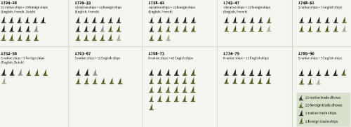
Shipping industry, 1700s
9789927118968/b-9789927118968_008-fig10_thmb.gif
9789927118968/b-9789927118968_008-fig10.gif
FIGURE 8.10
Shipping industry, 1700s
/content/figure/9789927118968.b_9789927118968-ch08.b-9789927118968_008-fig8.11
FIGURE 8.11
Pre-oil economic network
9789927118968/b-9789927118968_008-fig11_thmb.gif
9789927118968/b-9789927118968_008-fig11.gif
FIGURE 8.11
Pre-oil economic network
/content/figure/9789927118968.b_9789927118968-ch08.b-9789927118968_008-fig8.12
FIGURE 8.12
Subregional environment
9789927118968/b-9789927118968_008-fig12_thmb.gif
9789927118968/b-9789927118968_008-fig12.gif
FIGURE 8.12
Subregional environment
/content/figure/9789927118968.b_9789927118968-ch08.b-9789927118968_008-fig8.13
FIGURE 8.13
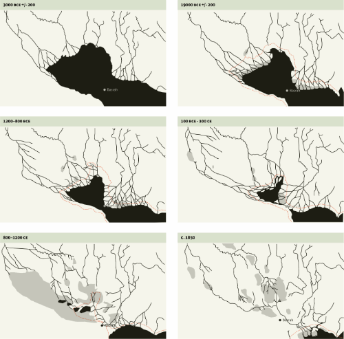
Land recession history
9789927118968/b-9789927118968_008-fig13_thmb.gif
9789927118968/b-9789927118968_008-fig13.gif
FIGURE 8.13
Land recession history
/content/figure/9789927118968.b_9789927118968-ch08.b-9789927118968_008-fig8.14
FIGURE 8.14
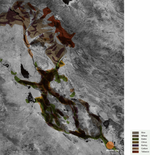
Crops
9789927118968/b-9789927118968_008-fig14_thmb.gif
9789927118968/b-9789927118968_008-fig14.gif
FIGURE 8.14
Crops
/content/figure/9789927118968.b_9789927118968-ch08.b-9789927118968_008-fig8.15
FIGURE 8.15
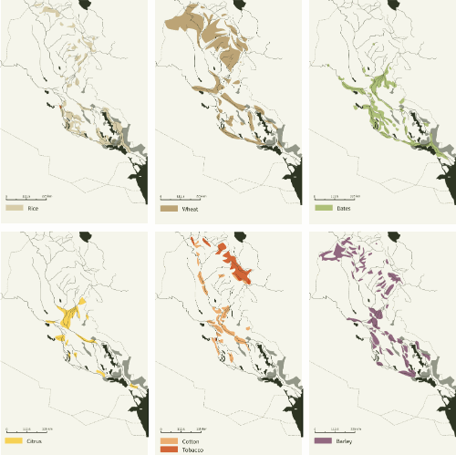
Subregional crops
9789927118968/b-9789927118968_008-fig15_thmb.gif
9789927118968/b-9789927118968_008-fig15.gif
FIGURE 8.15
Subregional crops
/content/figure/9789927118968.b_9789927118968-ch08.b-9789927118968_008-fig8.16
FIGURE 8.16
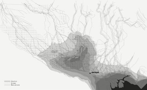
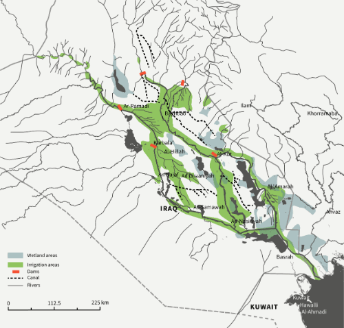
Hydrology
9789927118968/b-9789927118968_008-fig16_thmb.gif
9789927118968/b-9789927118968_008-fig16.gif
FIGURE 8.16
Hydrology
/content/figure/9789927118968.b_9789927118968-ch08.b-9789927118968_008-img8.2
IMAGE 8.2
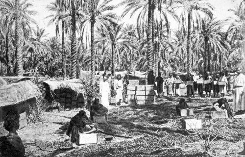
Dates being packed and bundled for export
9789927118968/b-9789927118968_008-img2_thmb.gif
9789927118968/b-9789927118968_008-img2.gif
IMAGE 8.2
Dates being packed and bundled for export
/content/figure/9789927118968.b_9789927118968-ch08.b-9789927118968_008-fig8.17
FIGURE 8.17
Local resources in the urban context of Basrah
9789927118968/b-9789927118968_008-fig17_thmb.gif
9789927118968/b-9789927118968_008-fig17.gif
FIGURE 8.17
Local resources in the urban context of Basrah
/content/figure/9789927118968.b_9789927118968-ch08.b-9789927118968_008-fig8.18
FIGURE 8.18
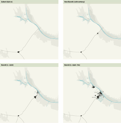
Subregional urban evolution
9789927118968/b-9789927118968_008-fig18_thmb.gif
9789927118968/b-9789927118968_008-fig18.gif
FIGURE 8.18
Subregional urban evolution
/content/figure/9789927118968.b_9789927118968-ch08.b-9789927118968_008-fig8.19
FIGURE 8.19
Physical morphology
9789927118968/b-9789927118968_008-fig19_thmb.gif
9789927118968/b-9789927118968_008-fig19.gif
FIGURE 8.19
Physical morphology
/content/figure/9789927118968.b_9789927118968-ch08.b-9789927118968_008-fig8.20
FIGURE 8.20
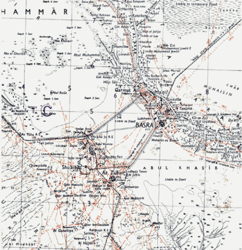
Map of Basrah, 1942
9789927118968/b-9789927118968_008-fig20_thmb.gif
9789927118968/b-9789927118968_008-fig20.gif
FIGURE 8.20
Map of Basrah, 1942
/content/figure/9789927118968.b_9789927118968-ch08.b-9789927118968_008-fig8.21
FIGURE 8.21
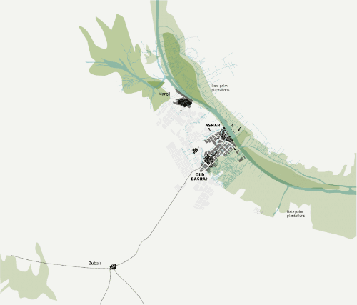
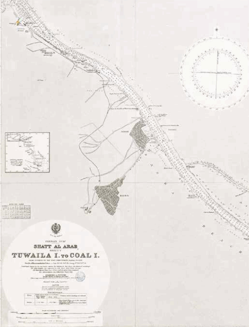
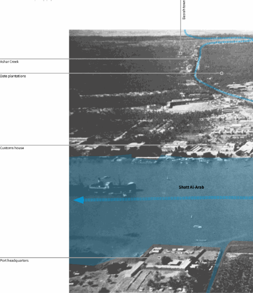
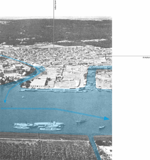
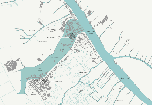
Twin towns of Ashar and Basrah City along Shatt Al-Arab
9789927118968/b-9789927118968_008-fig21_thmb.gif
9789927118968/b-9789927118968_008-fig21.gif
FIGURE 8.21
Twin towns of Ashar and Basrah City along Shatt Al-Arab
/content/figure/9789927118968.b_9789927118968-ch08.b-9789927118968_008-fig8.22
FIGURE 8.22
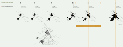
Evolution of the urban form
9789927118968/b-9789927118968_008-fig22_thmb.gif
9789927118968/b-9789927118968_008-fig22.gif
FIGURE 8.22
Evolution of the urban form
/content/figure/9789927118968.b_9789927118968-ch08.b-9789927118968_008-fig8.23
FIGURE 8.23
City evolution index
9789927118968/b-9789927118968_008-fig23_thmb.gif
9789927118968/b-9789927118968_008-fig23.gif
FIGURE 8.23
City evolution index
/content/figure/9789927118968.b_9789927118968-ch08.b-9789927118968_008-fig8.24
FIGURE 8.24
Area growth versus population growth
9789927118968/b-9789927118968_008-fig24_thmb.gif
9789927118968/b-9789927118968_008-fig24.gif
FIGURE 8.24
Area growth versus population growth
/content/figure/9789927118968.b_9789927118968-ch08.b-9789927118968_008-fig8.25
FIGURE 8.25
Waterfront versus city perimeter
9789927118968/b-9789927118968_008-fig25_thmb.gif
9789927118968/b-9789927118968_008-fig25.gif
FIGURE 8.25
Waterfront versus city perimeter
/content/figure/9789927118968.b_9789927118968-ch08.b-9789927118968_008-fig8.26
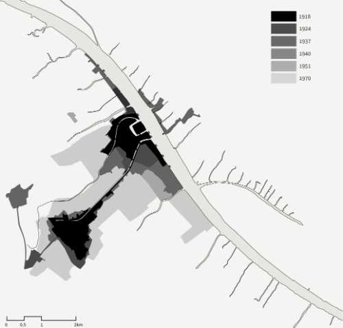
FIGURE 8.26
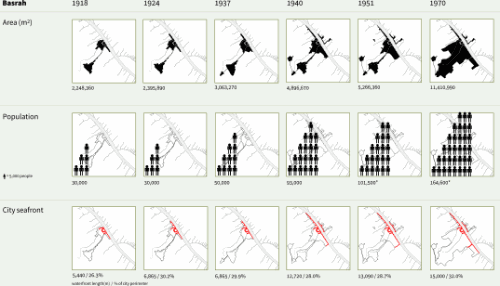
City growth, 1918–1970
9789927118968/b-9789927118968_008-fig26_thmb.gif
9789927118968/b-9789927118968_008-fig26.gif
FIGURE 8.26
City growth, 1918–1970
/content/figure/9789927118968.b_9789927118968-ch08.b-9789927118968_008-img8.3
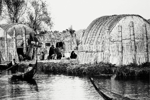
IMAGE 8.3
Reed house typology in the marshes to the south
9789927118968/b-9789927118968_008-img3_thmb.gif
9789927118968/b-9789927118968_008-img3.gif
IMAGE 8.3
Reed house typology in the marshes to the south
/content/figure/9789927118968.b_9789927118968-ch08.b-9789927118968_008-fig8.27
FIGURE 8.27
Urban fabric
9789927118968/b-9789927118968_008-fig27_thmb.gif
9789927118968/b-9789927118968_008-fig27.gif
FIGURE 8.27
Urban fabric
/content/figure/9789927118968.b_9789927118968-ch08.b-9789927118968_0027-fig27a
Untitled
9789927118968/b-9789927118968_008-fig27a_thmb.gif
9789927118968/b-9789927118968_008-fig27a.gif
/content/figure/9789927118968.b_9789927118968-ch08.b-9789927118968_008-img8.4
IMAGE 8.4
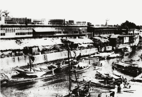
Waterfront for Shatt Al-Arab at Ashar
9789927118968/b-9789927118968_008-img4_thmb.gif
9789927118968/b-9789927118968_008-img4.gif
IMAGE 8.4
Waterfront for Shatt Al-Arab at Ashar
/content/figure/9789927118968.b_9789927118968-ch08.b-9789927118968_008-fig8.28
FIGURE 8.28
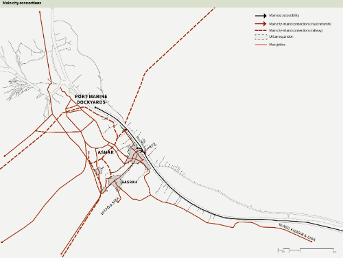
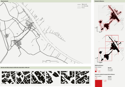
Accessibilities and street network
9789927118968/b-9789927118968_008-fig28_thmb.gif
9789927118968/b-9789927118968_008-fig28.gif
FIGURE 8.28
Accessibilities and street network
/content/figure/9789927118968.b_9789927118968-ch08.b-9789927118968_008-fig8.28a
Untitled
9789927118968/b-9789927118968_008-fig28a_thmb.gif
9789927118968/b-9789927118968_008-fig28a.gif
/content/figure/9789927118968.b_9789927118968-ch08.b-9789927118968_008-fig8.29
FIGURE 8.29
City built fabric, 1940s
9789927118968/b-9789927118968_008-fig29_thmb.gif
9789927118968/b-9789927118968_008-fig29.gif
FIGURE 8.29
City built fabric, 1940s
/content/figure/9789927118968.b_9789927118968-ch08.b-9789927118968_008-fig8.30
FIGURE 8.30
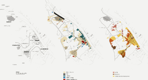
Land use
9789927118968/b-9789927118968_008-fig30_thmb.gif
9789927118968/b-9789927118968_008-fig30.gif
FIGURE 8.30
Land use
/content/figure/9789927118968.b_9789927118968-ch08.b-9789927118968_008-fig8.31
FIGURE 8.31
Views of Basrah, 1940s
9789927118968/b-9789927118968_008-fig31_thmb.gif
9789927118968/b-9789927118968_008-fig31.gif
FIGURE 8.31
Views of Basrah, 1940s
/content/figure/9789927118968.b_9789927118968-ch08.b-9789927118968_008-fig8.32
FIGURE 8.32
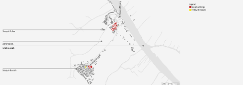
Souq analysis
9789927118968/b-9789927118968_008-fig32_thmb.gif
9789927118968/b-9789927118968_008-fig32.gif
FIGURE 8.32
Souq analysis
/content/figure/9789927118968.b_9789927118968-ch08.b-9789927118968_008-img8.5
IMAGE 8.5
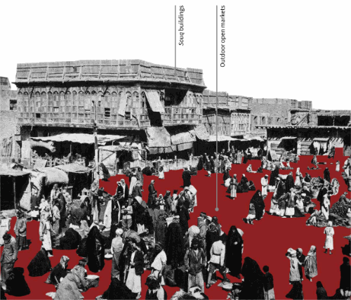
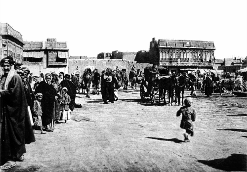
Baazar Square, Basrah
9789927118968/b-9789927118968_008-img5_thmb.gif
9789927118968/b-9789927118968_008-img5.gif
IMAGE 8.5
Baazar Square, Basrah
/content/figure/9789927118968.b_9789927118968-ch08.b-9789927118968_008-fig8.33
FIGURE 8.33
Relation of the souqs to the city
9789927118968/b-9789927118968_008-fig33_thmb.gif
9789927118968/b-9789927118968_008-fig33.gif
FIGURE 8.33
Relation of the souqs to the city
/content/figure/9789927118968.b_9789927118968-ch08.b-9789927118968_008-fig8.34
FIGURE 8.34
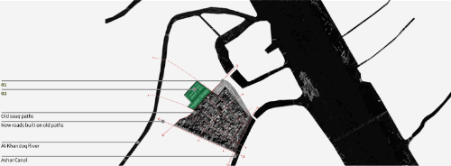
Zoning and road network in Souq Al-Ashar
9789927118968/b-9789927118968_008-fig34_thmb.gif
9789927118968/b-9789927118968_008-fig34.gif
FIGURE 8.34
Zoning and road network in Souq Al-Ashar
/content/figure/9789927118968.b_9789927118968-ch08.b-9789927118968_008-fig8.35
FIGURE 8.35
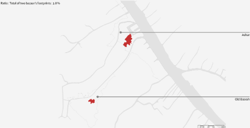
Ratio of the souqs to the city area
9789927118968/b-9789927118968_008-fig35_thmb.gif
9789927118968/b-9789927118968_008-fig35.gif
FIGURE 8.35
Ratio of the souqs to the city area
/content/figure/9789927118968.b_9789927118968-ch08.b-9789927118968_008-fig8.36
FIGURE 8.36
Relation of souqs to residential areas
9789927118968/b-9789927118968_008-fig36_thmb.gif
9789927118968/b-9789927118968_008-fig36.gif
FIGURE 8.36
Relation of souqs to residential areas
/content/figure/9789927118968.b_9789927118968-ch08.b-9789927118968_008-fig8.37
FIGURE 8.37
Neighbourhood fabric
9789927118968/b-9789927118968_008-fig37_thmb.gif
9789927118968/b-9789927118968_008-fig37.gif
FIGURE 8.37
Neighbourhood fabric
/content/figure/9789927118968.b_9789927118968-ch08.b-9789927118968_008-fig8.38
FIGURE 8.38
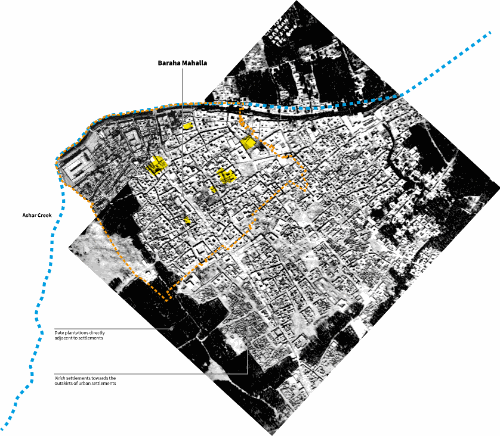
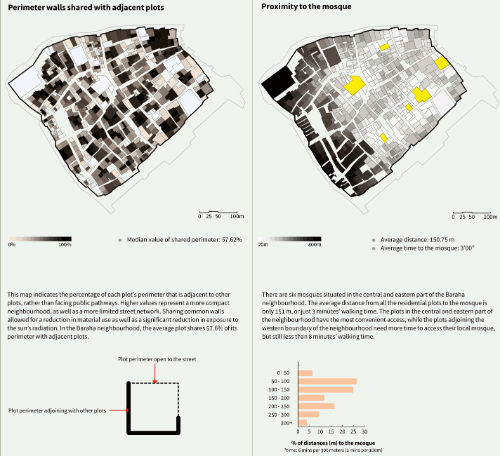
Selected neighbourhood: Baraha Mahalla
9789927118968/b-9789927118968_008-fig38_thmb.gif
9789927118968/b-9789927118968_008-fig38.gif
FIGURE 8.38
Selected neighbourhood: Baraha Mahalla
/content/figure/9789927118968.b_9789927118968-ch08.b-9789927118968_008-fig8.39
FIGURE 8.39
Neighbourhood character
9789927118968/b-9789927118968_008-fig39_thmb.gif
9789927118968/b-9789927118968_008-fig39.gif
FIGURE 8.39
Neighbourhood character
/content/figure/9789927118968.b_9789927118968-ch08.b-9789927118968_008-fig8.39a
Untitled
9789927118968/b-9789927118968_008-fig39a_thmb.gif
9789927118968/b-9789927118968_008-fig39a.gif
/content/figure/9789927118968.b_9789927118968-ch08.b-9789927118968_008-fig8.40
FIGURE 8.40
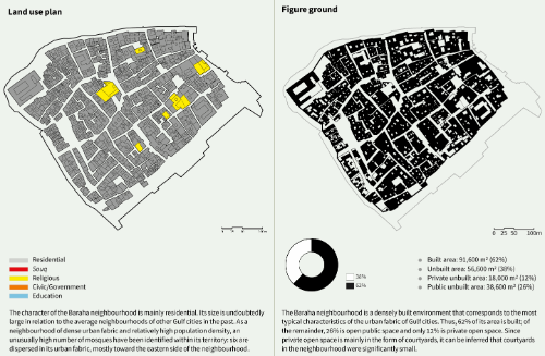
Neighbourhood analysis: Baraha Mahalla
9789927118968/b-9789927118968_008-fig40_thmb.gif
9789927118968/b-9789927118968_008-fig40.gif
FIGURE 8.40
Neighbourhood analysis: Baraha Mahalla
/content/figure/9789927118968.b_9789927118968-ch08.b-9789927118968_008-fig8.40a
Untitled
9789927118968/b-9789927118968_008-fig40a_thmb.gif
9789927118968/b-9789927118968_008-fig40a.gif
/content/figure/9789927118968.b_9789927118968-ch08.b-9789927118968_008-fig8.41
FIGURE 8.41
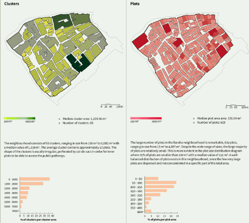
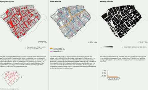
Neighbourhood analysis: Baraha Mahalla
9789927118968/b-9789927118968_008-fig41_thmb.gif
9789927118968/b-9789927118968_008-fig41.gif
FIGURE 8.41
Neighbourhood analysis: Baraha Mahalla
/content/figure/9789927118968.b_9789927118968-ch08.b-9789927118968_008-fig8.41a
Untitled
9789927118968/b-9789927118968_008-fig41a_thmb.gif
9789927118968/b-9789927118968_008-fig41a.gif
/content/figure/9789927118968.b_9789927118968-ch08.b-9789927118968_008-img8.6
IMAGE 8.6
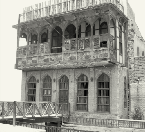
Traditional building, Basrah
9789927118968/b-9789927118968_008-img6_thmb.gif
9789927118968/b-9789927118968_008-img6.gif
IMAGE 8.6
Traditional building, Basrah
/content/figure/9789927118968.b_9789927118968-ch08.b-9789927118968_008-img8.7
IMAGE 8.7
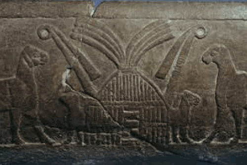
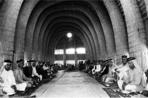
Carved gypsum trough from Uruk
Two lambs exit a reed structure identical to the present-day mudhif on this ceremonial trough from the site of Uruk in southern Iraq- Sumerian, c. 3000 bce, British Museum
9789927118968/b-9789927118968_008-img7_thmb.gif
9789927118968/b-9789927118968_008-img7.gif
IMAGE 8.7
Carved gypsum trough from Uruk
Two lambs exit a reed structure identical to the present-day mudhif on this ceremonial trough from the site of Uruk in southern Iraq- Sumerian, c. 3000 bce, British Museum
/content/figure/9789927118968.b_9789927118968-ch08.b-9789927118968_008-img8.8
IMAGE 8.8
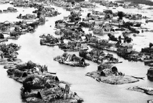
Aerial view of a Ma’dan floating village near Nasiriya
9789927118968/b-9789927118968_008-img8_thmb.gif
9789927118968/b-9789927118968_008-img8.gif
IMAGE 8.8
Aerial view of a Ma’dan floating village near Nasiriya
/content/figure/9789927118968.b_9789927118968-ch08.b-9789927118968_008-img8.9
IMAGE 8.9
A Ma’dan village
9789927118968/b-9789927118968_008-img9_thmb.gif
9789927118968/b-9789927118968_008-img9.gif
IMAGE 8.9
A Ma’dan village
/content/figure/9789927118968.b_9789927118968-ch08.b-9789927118968_008-img8.10
IMAGE 8.10
Among the Muntifiq
9789927118968/b-9789927118968_008-img10_thmb.gif
9789927118968/b-9789927118968_008-img10.gif
IMAGE 8.10
Among the Muntifiq
/content/figure/9789927118968.b_9789927118968-ch08.b-9789927118968_008-unfig6
Untitled
9789927118968/b-9789927118968_008-unfig6_thmb.gif
9789927118968/b-9789927118968_008-unfig6.gif
/content/figure/9789927118968.b_9789927118968-ch08.b-9789927118968_008-fig8.42
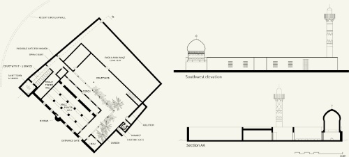
FIGURE 8.42
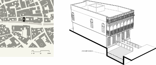
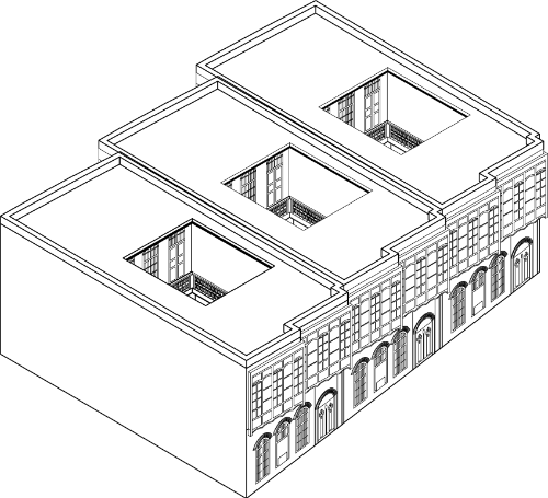
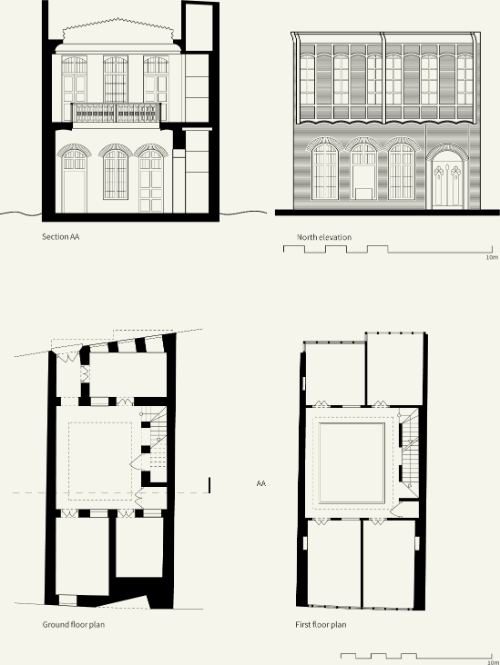
Plans and elevations
9789927118968/b-9789927118968_008-fig42_thmb.gif
9789927118968/b-9789927118968_008-fig42.gif
FIGURE 8.42
Plans and elevations
/content/figure/9789927118968.b_9789927118968-ch08.b-9789927118968_008-fig8.43
FIGURE 8.43
Plans and elevations
9789927118968/b-9789927118968_008-fig43_thmb.gif
9789927118968/b-9789927118968_008-fig43.gif
FIGURE 8.43
Plans and elevations
/content/figure/9789927118968.b_9789927118968-ch08.b-9789927118968_008-unfig7
Untitled
9789927118968/b-9789927118968_008-unfig7_thmb.gif
9789927118968/b-9789927118968_008-unfig7.gif
/content/figure/9789927118968.b_9789927118968-ch08.b-9789927118968_008-unfig8
Untitled
9789927118968/b-9789927118968_008-unfig8_thmb.gif
9789927118968/b-9789927118968_008-unfig8.gif
/content/figure/9789927118968.b_9789927118968-ch08.b-9789927118968_008-fig8.44
FIGURE 8.44
Plans and elevations
9789927118968/b-9789927118968_008-fig44_thmb.gif
9789927118968/b-9789927118968_008-fig44.gif
FIGURE 8.44
Plans and elevations
/content/figure/9789927118968.b_9789927118968-ch08.b-9789927118968_008-unfig9
Untitled
9789927118968/b-9789927118968_008-unfig9_thmb.gif
9789927118968/b-9789927118968_008-unfig9.gif
/content/figure/9789927118968.b_9789927118968-ch08.b-9789927118968_008-unfig10
Untitled
9789927118968/b-9789927118968_008-unfig10_thmb.gif
9789927118968/b-9789927118968_008-unfig10.gif
/content/figure/9789927118968.b_9789927118968-ch08.b-9789927118968_008-fig8.45
FIGURE 8.45
Plan and elevations
9789927118968/b-9789927118968_008-fig45_thmb.gif
9789927118968/b-9789927118968_008-fig45.gif
FIGURE 8.45
Plan and elevations
/content/figure/9789927118968.b_9789927118968-ch08.b-9789927118968_008-fig8.46
FIGURE 8.46
Configuration analysis
9789927118968/b-9789927118968_008-fig46_thmb.gif
9789927118968/b-9789927118968_008-fig46.gif
FIGURE 8.46
Configuration analysis
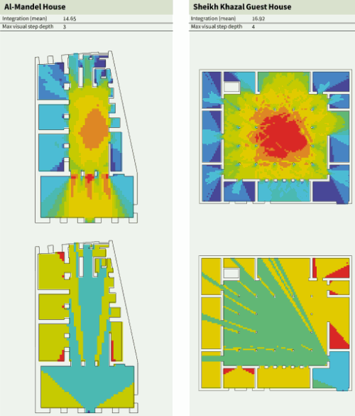
/content/figure/9789927118968.b_9789927118968-ch08.b-9789927118968_008-fig8.47
FIGURE 8.47
Visibility Graph Analysis
9789927118968/b-9789927118968_008-fig47_thmb.gif
9789927118968/b-9789927118968_008-fig47.gif
FIGURE 8.47
Visibility Graph Analysis
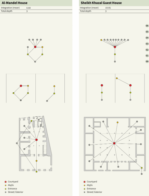
/content/figure/9789927118968.b_9789927118968-ch08.b-9789927118968_008-fig8.48
FIGURE 8.48
Justified Permeability Graphs
9789927118968/b-9789927118968_008-fig48_thmb.gif
9789927118968/b-9789927118968_008-fig48.gif
FIGURE 8.48
Justified Permeability Graphs
/content/figure/9789927118968.b_9789927118968-ch08.b-9789927118968_008-fig8.49
FIGURE 8.49
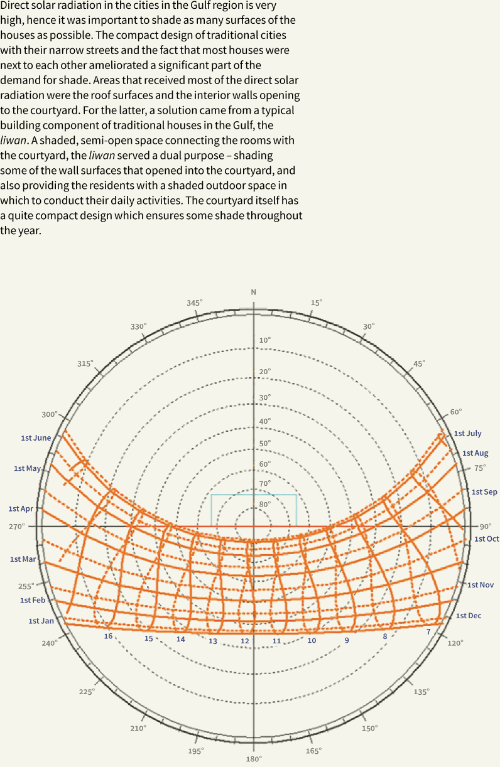
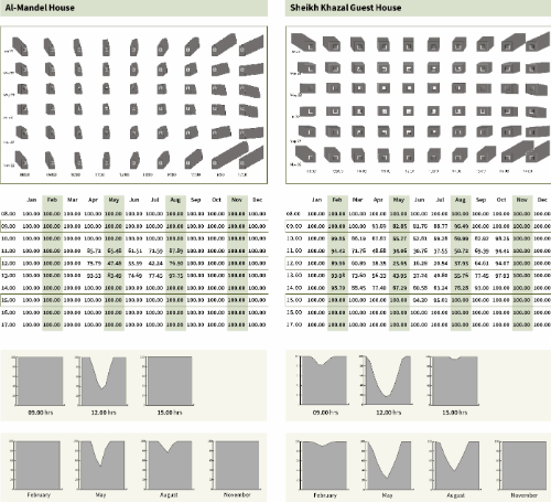
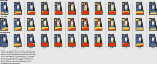
Shading analysis
9789927118968/b-9789927118968_008-fig49_thmb.gif
9789927118968/b-9789927118968_008-fig49.gif
FIGURE 8.49
Shading analysis
/content/figure/9789927118968.b_9789927118968-ch08.b-9789927118968_0049-fig49a
Untitled
9789927118968/b-9789927118968_008-fig49a_thmb.gif
9789927118968/b-9789927118968_008-fig49a.gif
/content/figure/9789927118968.b_9789927118968-ch08.b-9789927118968_008-fig8.50
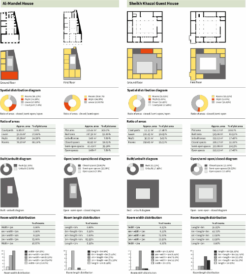
FIGURE 8.50
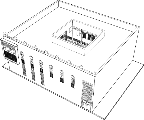
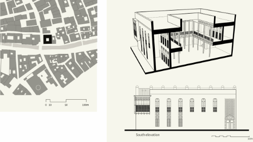
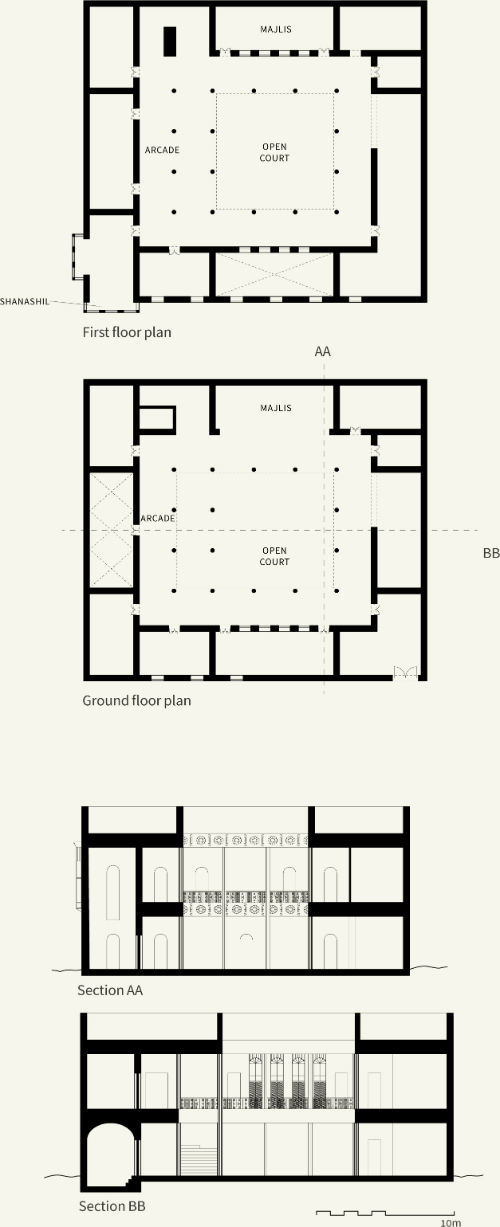
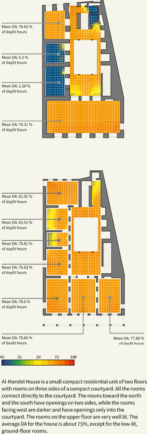
Al-Mandel House
9789927118968/b-9789927118968_008-fig50_thmb.gif
9789927118968/b-9789927118968_008-fig50.gif
FIGURE 8.50
Al-Mandel House
/content/figure/9789927118968.b_9789927118968-ch08.b-9789927118968_008-fig8.51
FIGURE 8.51
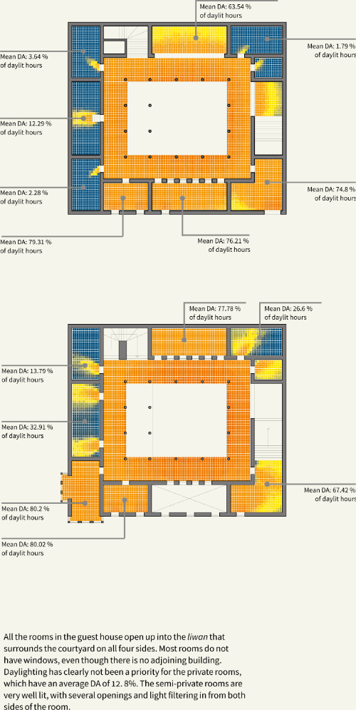
Sheikh Khazal Guest House
9789927118968/b-9789927118968_008-fig51_thmb.gif
9789927118968/b-9789927118968_008-fig51.gif
FIGURE 8.51
Sheikh Khazal Guest House
-
From This Site
/content/chapter/9789927118968.b_9789927118968-ch08dcterms_subject,pub_keyword-contentType:Journal -contentType:Figure -contentType:Table -contentType:SupplementaryData105
/content/chapter/9789927118968.b_9789927118968-ch08
dcterms_subject,pub_keyword
-contentType:Journal -contentType:Figure -contentType:Table -contentType:SupplementaryData
10
5
Chapter
content/book/9789927118968
Book
true
en


